At the end of 2013 the trail is open all the way from Snohomish to the Skagit County line, with a small section (a couple of miles) under construction between the Arlington cemetery and downtown Arlington. Snohomish County has purchased the railroad right-of-way from Snohomish to Woodinville from the Port of Seattle and is talking about developing a shared-use corridor with both rail and trail. There seems to be support for developing the Whitehorse trail to Darrington as a branch off of the Centennial trail and there is talk of a trail between Snohomish and Monroe. Lots of interest in cycle tourism in Snohomish
I’d like to see them link up the Interurban and Centennial trails with a development of the Lowell River trail. I’d like to see them link up the Cascade trail (in Sedro Wooly) with the Centennial trail. I can’t wait for the Woodinville to Snohomish trail to be built.
Here’s a link to the Centennial Trail page on the Snohomish county web site.
Part of this trail is on the grade of the old Monte Cristo railroad. Here is a book list.
The trail is really flat – like most rail-trails. It goes slightly uphill for about 16 miles from Snohomish and then there is a down-grade for the last mile to Armar Rd. (Then it is flat again into Arlington and very little up or down on north to the Skagit County line.) There is only one significant street crossing – and that has a light. There are several minor street crossings. There are gates or posts by each street and driveway. We counted once and found 36 pairs of barriers on the one-way ride from Snohomish to Armar Rd.
Sometimes when we ride the Centennial Trail there are cougar warning signs at the trailhead and on some of the barriers. We’ve never seen anything larger than a rabbit.
I predicted that at the North end (Armar Rd.) the trail would eventually follow the visible grade on down to 172nd where it connects with the sidewalk-style trail segment (completed in 2010.) It will be nice when it continues on 167th into downtown Arlington, and but it was really fantastic to see it go all the way to the Skagit County line (at the end of 2012.) When King County talks about buying the BNSF right-of-way on the east side of Lake Washington they mention that it will hook up with the Centennial Trail. I presume that means that the South end of the trail will extend on down Maple (done in 2012 but with a really awkward crossing at 2nd St.) There is a high wooden trestle across the river at Cady park and then the maps show a railroad grade next to Springhetti and Connelly down to the Woodinville – Snohomish Road ending up in Wilmot Gateway park. Now that would be a ride.
Here’s a link to an article about the final sections and plans. And an update. And another update. (They’re working on it – here’s the request made to the Feds)
December 2011 – we rode the new section between Armar Road and Arlington and it’s nice! Here’s an article about the status of the trail as of October 14, 2011: basically by the end of 2011 they expected to have the southern end connected to the trail along the river in Snohomish and they’ll do something about the section just south of downtown Arlington where you currently ride 67th before it goes under ST 9. In the spring of 2012 they expected to open the section from Bryant to the Skagit County line.
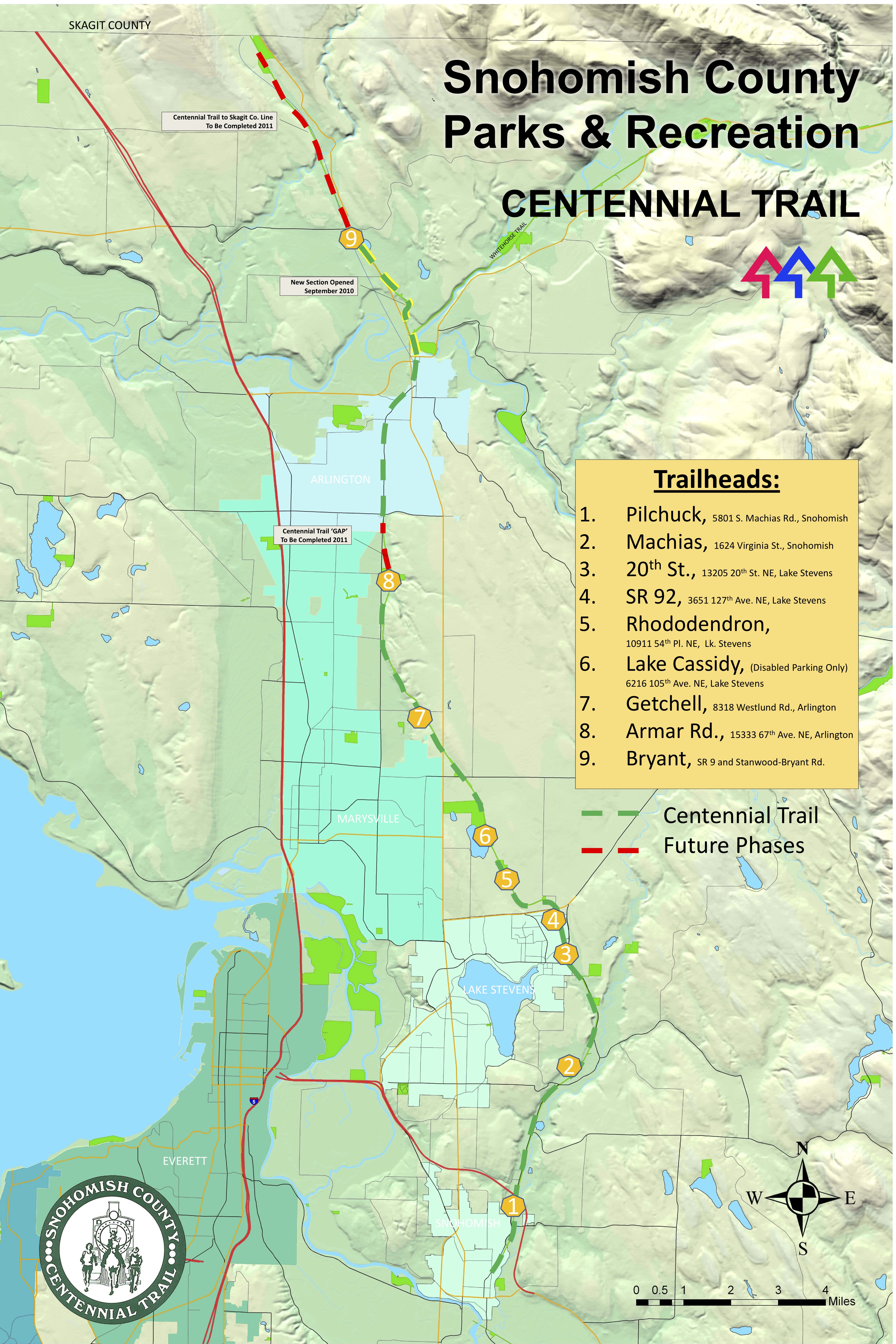
Here’s a map showing the status of the trail in September 2010 with the first four miles or so of the northern extension accessible: