Carrie wanted to climb Mt. Carrie in the Olympics and asked me if I’d come along. I said that it would be cool to do it as part of a Bailey Range traverse since you had to do the first part of the traverse to get to Mt. Carrie anyway. A few months later we talked about it again and agreed that we’d really do it the next summer. When Alex and Carrie asked about scheduling I suggested that we plan for a full week with both weekends and that we do Olympus on the way out. After some discussion we agreed and set dates and planned to get out on a lot of climbs in the spring to get in shape and prepare since Alex & Carrie had never done a long backpack before. In June I realized that we hadn’t gotten permits and convinced Alex to figure that out – he called the Park Service and found out that reservations were required but that they were only available one month in advance. We confirmed dates, figured out an itinerary, and when the time came Alex called and locked us in.
Of course it didn’t work out as planned. The spring was cool and wet and not conducive to outdoor stuff. We were going to do a series of backcountry ski trips but we had an unfortunate experience on Granite Mountain the first time out and didn’t try again. Alex and I tried Mt. Daniel while Carrie was studying for an exam but we didn’t get the main summit because of the weather. The three of us tried Little Tahoma but I had a bad cold and couldn’t keep up so we backed off… The only hike the three of us did successfully in preparation for the Bailey Range was a day trip up Snoqualmie Peak.
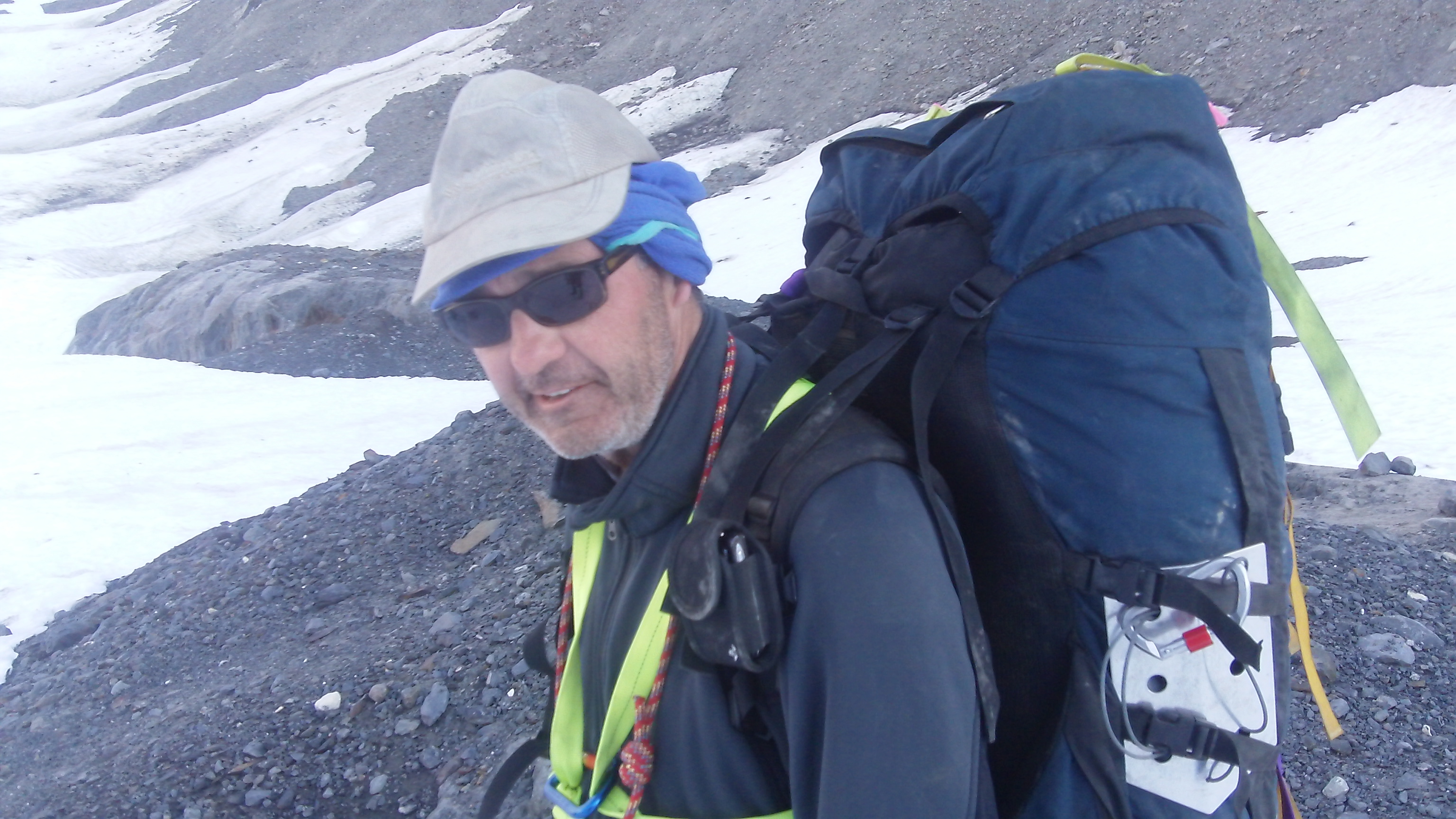
We did spend a little time online looking at trip reports and route descriptions. We talked about equipment needs and vowed to eliminate all duplication and excess stuff. Both Alex and I made trips to REI for freeze dry and miscellaneous stuff. Alex bought a new pack. I bought liner socks. I had Odette pick me up a dozen snickers bars and some cashews. I weighed my pack at 55 pounds without the rope or water or ice axe. Alex and Carrie showed up at 7:00 on Saturday morning, we loaded my pack into their car and took off.
We got permits and bear canisters at the Port Angeles Ranger Station and headed for Sol Duc. The rangers all seemed envious of our plans. We stopped at the resort and had burgers by the pool. We hit the trail at about 1:00 to hike the 10 miles to Heart Lake. I had a bear canister horizontally on top of everything else in my pack – with the rope on the side. The canister fit inside the snow skirt but it was just barely too big to slide down inside the drawstring that closes the top of the pack proper. We missed the “seven lakes basin” sign at Sol Duc Falls and spent an hour bashing about on the wrong side of the river wondering where the trail had gone. We met a succession of travellers who warned us about snow in the Baileys, rugged country in the Baileys, potential wrong turns in the Baileys, etc. They all seemed envious, too. There was a bridge out before Sol Duc Park but we danced across. Later I got my feet wet crossing an easier stream.
There were people in the best campsites at Heart Lake. The only obviously available site had a stream running through it flooding the tent pad. We revisited the sites on the other side of the outlet stream and found a couple of empty sites high on the hillside away from the water. Alex pumped from the outlet stream and a bird pretended to be injured to lure him away from her nest. It was late – we basically ate and went to bed. I woke up later to a full moon making things almost as bright as day.
The next day I put on wet socks and boots and we hiked up to the high divide trail and took it to the end. Based on the on-line route descriptions I was expecting some confusion about locating the climbers’ path up the the catwalk, but it was obvious since about twenty feet further the trail ended at the edge of a cliff. We hauled our heavy packs up the ridge on a loose, dirty climbers’ trail through trees and brush and eventually topped out at a small platform that gave us our first view of the arrete. I was surprised by the steepness with which it dropped off and by the thickness of the vegetation covering it. We down-climbed the catwalk lowering ourselves off rocks and trees and sliding down dirty slots. In one of the chutes Alex lost Carrie’s sleeping pad off his pack and it came to rest in a tree with a couple of hundred feet of air beneath. I climbed out and retrieved it. About halfway through the down-climb we started hearing voices above us and realized that we had another party assembling at the top of the catwalk. I wanted to hurry and get out of the way so that they wouldn’t kick stuff down on us, but the terrain was hard enough that it didn’t seem very smart to rush things.
The end to the catwalk came suddenly in a little clearing with a pond of meltwater from a big snowbank. When I arrived at the tail of the group Alex and Carrie announced “this is Boston Charley’s,” and they were right. We plopped down to claim the space and shortly were overrun by a group of eight climbers on a guided Mountain Madness trip (Alex says they charge about $1,700 – all of the clients seems to be from the east coast.) We exchanged greetings and commiserated about the catwalk and learned that they also planned to camp at Boston Charley’s. We said that we were off to climb Mt. Carrie and started setting up our tent in the only available site. They regrouped and talked about seven-bull basin and a carry over and then announced that they were going to dig platforms in the snowbank. We spotted a bear crossing a patch of snow across the valley and then another on a snowbank lower down. Eventually we strung a water bottle on a runner and set off for the climb.
We followed the trail for maybe half a mile on the shoulder of the mountain and then headed up through meadow toward the peak. A boulder field turned to bigger rocks and then to snow and a couple hundred feet below the summit Carrie decided to wait for us. Alex and I crossed three or four snowfields (some fairly steep) to gain the summit at 5:30. We looked at the glacier and prayer flags and the view but couldn’t find a summit register. We left without wasting too much time and descended the snow to where Carrie was waiting. At that point we encountered the Mountain Madness guys going up. We cut through their camp on the snow on our way back to our tent.
We were joined at Boston Charley’s by a herd of goats – eventually numbering about 20 – and we observed their antics through the evening. I hung my pack on a tree to keep it away from the goats. We could see the boats on the strait as the sun went down and I texted a goat picture to Odette. Alex posted to his facebook page. When I took my boots off my feet were white and waxy and smelled strongly of cheese. The moon was bright again but mainly hidden by the trees on the other side of the pond from me.
In the morning we hiked through the Mountain Madness camp again and followed the trail over the shoulder of Mt. Carrie. The day was only supposed to be 5 miles or so and the first section on the trail was easy with good views and nothing tricky. Then came the gully crossings. After several steep gullies with lots of loose rock and steep sides we came to a serious one that involved maybe 30 feet down on loose dirt before a similar climb up the other side. I lowered the packs with a hip belay and one after the other we slid down the dirt – scraping packs and skin in the process. Carrie’s pants ended up worse for the wear – but nothing a little duct tape couldn’t cure. Other gullies involved serious exposure (and a dropped ice axe), waterfalls (solved with a foot jam mid-stream) and steep snow. We climbed what I thought was the final ridge before the lake only to find that it hid a small basin with a second higher ridge behind. We noticed the Mountain Madness group on the traverse behind us as we left the basin. I had to adjust my pack because the bear canister seemed to want to slide off to one side. We climbed the second ridge then missed the cairn marking the place the route guide said to leave the trail. Alex started bulling his way through the brush and we called a halt – but we couldn’t find any obvious continuation of the trail. I was skeptical – mainly because I didn’t want to climb back up – but we eventually retraced our steps and realized that we had made the mistake warned against in at least two of books we’d read. We also met up with the Mountain Madness guys who helpfully pointed out our mistake for us.
We left the trail and tried to follow the “obvious” game trail under the rocks but the temptation to drop down was too great and we found ourselves bashing our way through the brush again. We climbed some more and then watched as the Mountain Madness guys passed us on a good trail. We followed them to a meadow where they dropped into the trees. We dropped in too, and then spent the next hour and a half fighting with avalanche debris and thick brush and bear scat and bugs as we worked our way down to the valley floor. By the end we were convinced that the initial brush bash might not have been such a bad idea.
We never saw Cream Lake close up. The water in the inlet stream was over the banks and the only way to approach the lake was through thick brush and we didn’t see the point. We managed to find a clearing next to the stream and we set up camp amid the bugs. Upstream we saw one of the Mountain Madness guys poking around and we surmised that they also ended up camping on the stream instead of on the lake. The ground was wet, the bugs were thick, the view was obscured by the brush – but it was a wild place (think Alaska) and the meadows / slide tracks we descended through reminded me of the Ingalls Creek valley below Mt. Stewart. A buckle on Alex’s new pack broke and we improvised a loop with cable-ties so that he could still adjust the strap. When the moon came up in the trees I thought it was a gas lantern in the Mountain Madness camp. .
There was a heavy dew overnight and in the morning we dried tents and stuff off in the sun and then we followed the stream upriver. When it started to push us onto a sidehill we crossed (Alex made contact with the Mountain Madness guys and after some dithering we crossed where they had.) We waded the stream in boots with no socks at a point where it was wide and shallow. A little later we crossed back over – and repeated the process a couple more times in quick succession. As the valley narrowed and steepened we bore left searching for a track. We ended up in a gulley with a little stream in the center and climbed that for several hundred feet. We topped out in a pretty upper valley that was full of little ponds and tarns and mainly covered with snow. We could see well beaten trail and further up slope we could see boot tracks in the snow that we assumed were Mountain Madness related. We followed the tracks up and down as we climbed up the valley – eventually coming to a final slope leading up to the saddle between Mt. Fairy and Mt. Pulitzer. As we climbed that slope we saw the Mountain Madness guys setting up tents on the saddle. We approached a bench a couple hundred feet below the saddle and saw that it contained a small lake with an unfrozen outlet culminating in a peculiar waterfall that started out horizontal. We camped near the outlet on a flat sunny gravel pad. The sun was intensly hot so we rigged sun shades from a ground cloth and Alex’s rain fly. I discovered that I was missing my haul cord and carabiner – probably left on the branch at Boston Charley’s since I hadn’t hung anything at Cream Lake. (I had also lost my bandana in the brush before Cream Lake.) The moon was intensly bright and I kept rolling over to be able to sleep in peace.
The next morning we climbed up to the saddle, arriving just after the Mountain Maddness guys left. We climbed over the shoulder of Pulitzer and did some up and down on rock and snow along the ridge to Mt. Childs. The going was easy, the views were great. We recognized the tree at Lonetree Pass from the picture in the climbing guide. Bear Pass was wide and snow covered so we climbed the point on the far side and started the descent. The Mountain Madness tracks led down the snow instead of down the ridge, so we followed with the intention of camping in the first good spot we saw. We paused at a small heather covered shelf with running water just below the crest of the point. While we could have squeezed our camp onto the shelf (even with the running water) it would have been tight and we were still looking for something better. We saw the Mountain Madness guys congregated on the flats below us and we didn’t want to camp on top of them but we decided to continue down and find a camp site at the near end of the basin. The snow on the descent was steep but very soft and plunge stepping was secure. As soon as the slope eased off we found a gravel hog-back. Alex climbed up it and found a flat spot about half way down the other side. He also found a trickle of water he thought he could pump from.
It was hot again and we rigged up the sun shades. The water proved elusive so we fired up both stoves and melted snow. The moon was very bright and illuminated snow patches so that the basin looked like the illustration on the front of the old edition of the Olympic Trails guide. Our plan was to get out early the next morning and head for Camp Pan since we were nearly a day ahead of schedule as it was.
The snow was crunchy in the morning but we didn’t need crampons as we walked down to the the place where the river appeared from under the snow. I put my bear canister down inside my pack (vertically) for the first time – now all my fuel and some of my other small items were inside the canister so there was plenty of room for it inside the pack. We filled water bottles and pumped and then continued on the far side of the river on a circuit around the basin looking for the bench where the guide said we were supposed to climb through meadow. We started climbing with heavy packs and slippery vegetation and soon we were in brush right under the cliff bands. We had trouble locating the game trail the guide said we would find – we tried a couple of routes in the rocks and we looked lower down and finally Alex bulled through the brush until he found somebody’s button on the ground and realized that it was a trail. That trail took us around the corner and with a little more brush bashing we were in the “beautiful hidden basin” that was our original destination for the evening. We saw a group that we took to be the Mountain Madness guys climbing roped on steep snow beside the glacier. We had no trouble with the stream crossing but beyond that we had no luck finding the trail that was supposed to take us into the next gully. Alex and I both explored without finding a track; eventually we gave up and followed a faint game trail that seemed to be headed in the right direction. That was a mistake and we back-tracked, climbing back up a steep hillside. I found the remains of a rucksack and a moldy plastic tube tent so we knew we weren’t the first ones on that slope. Alex figured out that we were only a few hundred feet away from the waypoint in the gully on his GPS so he simply went to that point and then looked for the path of least resistance to where Carrie and I were standing. Naturally there was a good trail – which we had missed despite all of our scouting. We got across that gully and then over the rocks and rubble to the next gully and the stream draining from the Humes Glacier. We rehydrated and then started upstream. We saw two rope teams of four heading up the Humes. Below the headwall we saw tracks in the snow heading up to the left and we followed them. This got us onto the steep snow we had seen the Mountain Madness guys ascending earlier and at the top it traversed above steep wet slabs. We climbed cautiously but with no issues and found ourselves on top of the terminal moraine where we saw a solo hiker with a big pack descending the glacier. We headed down into the space between the glacier and the moraine where there were several gravel pads and running water and we decided to spend the night at the snout of the glacier rather than compete for space at Camp Pan. There was rockfall all night – but not too close. The moon meant that there was no need for a headlamp.
In the morning the snow was crunchy but not hard enough to warrrent crampons. We roped up and left camp early heading up the glacier and aiming for Blizzard pass. The Humes had almost no open cravasses and was almost flat so climbing was easy. The snow below the pass was steeper. The pass was still in the shade and was frozen to the point where crampons seemed like a good idea. Halfway down the slope to Camp Pan we were back out into the sun and the snow was balling up under our feet. We stopped just above the camp and took off our crampons then got back into the shade on the descent to the glacier. We followed the Mountain Madness guys tracks through the cravasses – but the glacier was very flat and for the most part the cracks weren’t open. We angled across the glacier and headed up toward Glacier pass on steep snow. I wondered if the track we were on was where we wanted to be but I knew that the guys we were following intended to climb Olympus and I knew that the custom correct map had two swoops connecting at the pass so I figured we had to be allright.
The situation at the pass was unexpected, though. The Mountain Madness guys had continued over the pass, evidently on the traverse route to Glacier Meadows instead of on a route to the summit. The face of the East Peak overlooking the pass was too steep to consider seriously and there were big snow seracs hanging dangerously over what might have been a route. After much consultation and study of the maps and the route descriptions and the GPS we realized we had three options: 1) descend the pass to the Hoh glacier and climb the East Peak from the head of the glacier, 2) climb an ascending traverse from the pass to the summit of the East Peak, or 3) follow the Mountain Madness guys over the pass and climb the standard route. The risk of descending back to the Hoh was that the headwall had looked intimidating from the glacier and if it didn’t go we’d have to climb back up to the pass. The risk of the traditional route was that if we climbed from glacier meadows the next day we’d end up with 17 miles to hike out on the final day of the trip. The risk of climbing the East Peak from the pass was that the terrain looked scary – so we set off on an ascending traverse. (While deliberating we saw a rope-team of 4 – presumably the Mountain Maddness guys – climbing up a snow slope on the other side of the pass. )
Alex led a line at a much lower angle than I expected and after about a rope-length I hollered to him and pointed out that we needed to go above the rocks not below. He wanted to stay at pass level and traverse around the peak to where the route from the glacier would intersect the traverse – probably not feasible from what I remembered of the wall we’d seen on the glacier but I agreed that he ought to go out far enough to see around the corner. In the process Carrie fell and arrested twice. What Alex saw from the corner was enough to convince him that it didn’t go, so we retreated to the pass again. At that point we realized that the slope we’d last seen the Mountain Madness guys on wasn’t just on the other side of the pass – it was on the other side of the Blue Glacier and was in fact the approach to the snow dome. We could follow their route and climb the standard route without going back to glacier meadows by crossing the glacier – so we did just that.
The Blue Glacier is wide at that point and the crossing wasn’t quick. Alex suggested a rest about three-fourths of the way across and I countered with a suggestion that we ought to get to the other side first. We crossed and hiked a little way up the slope on the far side before stopping on some rocks in the sun. As we rested we saw a solo climber descending and it turned out to be the ranger stationed at glacier meadows. He told us that we were two hours into a 12 – 14 hour climb and suggested that we at least get up onto the snow dome. He also told us that the solo climber we’d seen on the Humes was a guy called Skinner who worked part-time for the park service and the UW and who was probably on his way to the Quinault. He also seemed envious of our trip and said that the was going to do it in reverse in a few days with some people who hadn’t done it before. In the warm afternoon sun we lacked motivation – me because I’d climbed Olympus before and Alex & Carrie because they didn’t see the point. Eventually we decided to head for camp and abandon the climb. We had a long hike down the glacier (passed by an unroped party of four that gave us funny looks) and Alex post-holed in to crotch depth as we left the glacier. We unroped and climbed up to the lateral moraine, then walked the trail to camp. I remarked on the yurt – new since I was last there – and the generally more developed feeling of the campsites. We dropped packs in the first tentsite we saw and I went to use an outhouse that looked like a tree had fallen on it. Alex found a site nearer to water so we moved and set up camp – amid bugs and chipmunks. My half-liter water bottle disintegrated – so I stomped it flat and put it in my trash bag. The ranger came by later and we talked for a while. He assured us that we could get an extra day on our permit if we needed and that below Lewis Meadows there was no quota and thus no permit needed to camp. Still a full moon, but before we went to bed Alex broke out a flask in celebration…
The next morning we started the long hike back to the Hoh visitors center. The first gully got our attention with a hundred-plus foot rope ladder. The trail was pretty much as I remembered, a steep drop for the first two or three miles then river bottom flat. We got to the Olympic Guard Station in the early afternoon and set up camp, then hung out on the gravel bar for a few hours. Thunderheads materialized in the afternoon and I put everything in my bivey sack and zipped it up in case of rain. Later we noticed a ranger in the station and went to talk – she turned out to be a geology student from Smith College who talked Alex into giving her his bear canister so that she could join the guy at glacier meadows in a hike to Sol Duc. (Turns out his name was Sam and he worked in a bike shop in Phoenix during the off-season.) Being down in the bush also offered shade from the moon – I woke up in the middle of the night to something glowing white in front of Alex & Carrie’s tent and it took me a while to realize that it was Carrie’s helmet in a spot of moonlight.
The last day was the first time we had cloud cover while on the trail – welcome for the eight miles we had left to hike. Half way to the visitor station we scared out a herd of elk. As we got closer to the parking lot the tourists got more annoying. I realized that I had carried the rope the entire trip. I also realized that despite having used up pretty much all of my food and fuel, my pack didn’t feel that much lighter at the end of the trip than it had at the beginning.
At the visitor station we were disappointed to find out that there was no water! (An emergency appropriation had been received to rebuild the drainage system but the sinks were dry, so no wash-up for us.) We waited two hours for Odette to arrive with the car. (She was coming form Portland where she filled in for me at a family gathering – she ended up driving over 700 miles that weekend.) The people who talked to us had no concept of what it means to carry a sixty pound pack and to spend eight nights in the woods.
Odette parked in an RV space and the parking lot ranger gave us a bad time. We changed into clean clothes and headed for Sol Duc and Alex & Carrie’s car, stopping at the resort for ice cream. (The deli was closed but they had bars in the gift shop.) An old guy got impatient with us when Odette wanted to finish her ice cream before moving the car. Alex & Carrie were almost out of gas…
We headed for Port Angeles to drop off the bear canisters. The ranger there gave Alex a bad time for giving his canister to the ranger at the guard station. We went to a restaurant on the waterfront where the waitress couldn’t remember about crackers or ketchup and wasn’t concerned about keeping the beer glasses full. The burger still tasted pretty good. I slept some on the way home – via Tacoma since we didn’t coincide with the Southworth ferry schedule and the wait times were long in Kingston. I didn’t unpack – just took a shower, shaved and was in bed by midnight without paying attention to the status of the moon. (I found out in the process that there was no shaving cream in the house.) I went to the gym the next morning and showered and shaved again, finding when I weighed myself that I’d lost seven pounds during the trip. That evening I ran the laundry (twice because there wasn’t any laundry detergent in the house, either) and went to bed early.